Showing posts with label Utah. Show all posts

Sunday, October 28, 2007

Colorado Plateau - Arches National Park


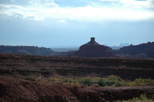
Arches National Park, Utah, USA is at the northern edge of the Colorado Plateau and may be one of the best known features of this huge sandstone tableland. Arches National Park contains the world's largest concentration of natural stone arches.

This park is a red desert, punctuated with eroded sandstone forms such as fins, pinnacles, spires, balanced rocks, and arches. The 73,000-acre region has over 2,000 of these "miracles of nature."

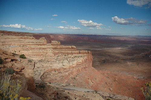
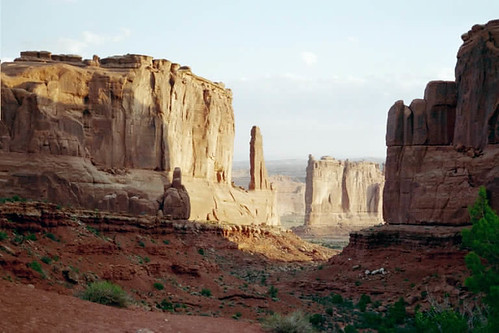
And the park brochure my sister and I picked up the first evening we entered the park said it could be seen in 2 to 2 1/2 hours. Five days later we were still making twice daily trips to photograph this arch or that arch or that pinnacle per a guide we found on line detailing whether morning or evening light was best. One of the most known arches is Delicate Arch shown above (photograph by the Utah Visitor's Center). But one of the most stunning views is Park Avenue, the first Kodak photo opportunity upon cresting the top of the mesa on a road that takes your breath away.


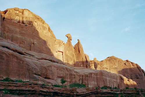
There is a 2 1/2 mile trail that passes through these fins and pinnacles. We didn't take it because it was 2 1/2 miles back and we were aware the morning that we photographed this wonderful view that we were not going to have enough time to photograph everything of beauty. We did go part of the way down the trail which gave us this view. I think it looks like a Pharaoh and his Visor parading toward the rising sun.


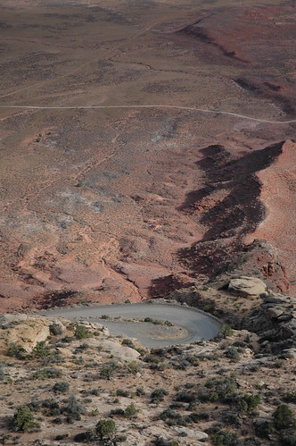
Trails are on sandstone or slick rock and so paths are difficult to see unless they are marked by stones something the National Park Service does very well. You very quickly learn to follow the carrions or stone stacks and to set them up yourself when crossing open territory. And it rapidly becomes a good luck action to add another stone on top. Being very careful, of course to not knock it over.


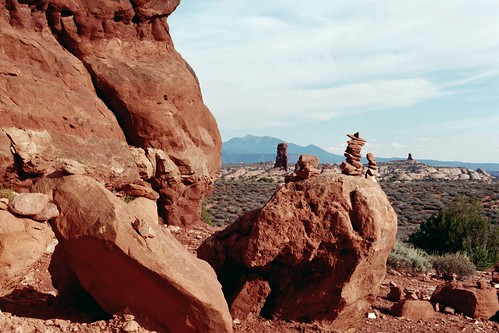
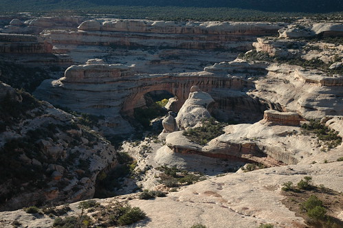
Below is a massive stone fin which can be seen for miles in all directions. Mother Nature is the mistress of stone piling though this is mostly one rock, one huge rock.


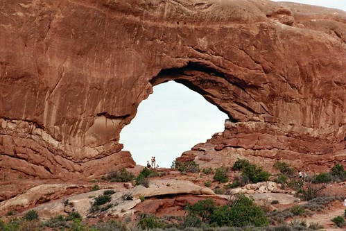
Fins (stone formations longer than they are wide) often erode into arches like the one below. I was trying to wait for everyone to move out of the picture when it dawned on me that this grouping within the window of the arch give the viewer a fell of the size of these formations.


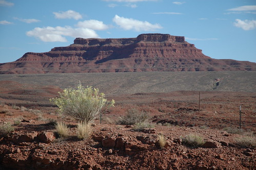
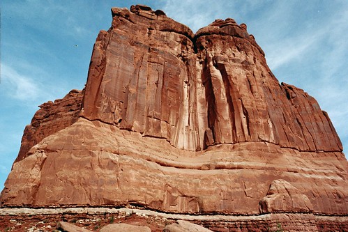
The lines along its base indicate that the pushing up of this once sedimentary sea floor was not universally even. The vegetation is typical of high mesa land in the southwest.

For more information on Arches National Park I refer you to the Utah website and for a Map of the area.

Next Colorado Plateau post will have more photos of Arches and continue into nearby Canyonlands.

Friday, October 26, 2007

My Views of the Colorado Plateau

Mystic Passage


I love the Colorado Plateau and it often serves as my muse for my paintings. The following paintings were all created from pictures I took in my travels around various sections of this high mesa area lapping over the states of Colorado, Utah, Arizona and New Mexico.

My subsequent post will feature some of the photographs of landmarks that were used as inspiration for these paintings.

To the left is Mystic Passage which was inspired by Double Arch at Arches National Park in Utah, USA. and one of the most noteworthy and known areas of the Colorado Plateau.

Trail to Arsenic Springs


It is 24 x 18 mixed media on canvas depiction of the Wild Rivers Park on the Rio Grande Gorge in Northern New Mexico; the eastern edge of the Colorado Plateau. And I was practicing stormy skies and a slightly more subdued palate to indicate less than full sunshine. I needed to practice that for the following painting: Escalante After the Rain, which is inspired by my sister's and my house boat trip on Lake Powell. After heavy rains waterfalls formed on the canyon walls and transformed the canyons.


This is the 24 x 36 inch canvas I was so afraid to attempt. I don't think the photograph of this work does it merit because I have put in metallic silver and gold into the waterfalls and a luminescent paint on the slick rock walls of the canyon in the distance.

While I was doing these two paintings I decided to revisit a painting I had done two years ago of Bowtie Arch at Canyonlands Utah. It was taken from a less than successful photograph that I decided to play with on my computer in Photoshop and then print on watercolor paper and add paint to. It sold at its first public viewing and I have sold numerous prints. It is a somber piece. And I was just curious to see if it could be brightened up in keeping with my new style. This is the result.


I call it Coyote Portal II and it is a 14 x 11 mixed media on canvas board.

The Navajos believe that Coyote came up through a hole in the earth and led the people or Dinah to the earth they now inhabit. Looking at this arch in a side area of Canyonlands, Utah I was reminded of this story.

The lands of the Colorado Plateau are indeed magical and inspire a lot of photographers and artists and writers.

Monday, October 22, 2007

Back to the Colorado Plateau


Rather than focus on one of the National and State Parks that abound in the Colorado Plateau area I figured I would just highlight some of the natural land features. For those of us familiar with this area of the country there really is no such thing as a bad view. And the effect of wind, rain and time have created some fantastic formations.

The one to the right is of Navajo Sandstone - it's the white stuff. Usually when people think of sandstone they are apt to think of the red stuff like found in the Grand Canyon. The following rather typical "wedding cake" formation is of the red sandstone.


The hints of sage green in the middle ground are vegetation very much like that in the foreground; rabbit bush, snake weed, gamma grass. Livestock has to walk a long way to get a meal and even further for water.


This photo was taken working up and over one of those wedding cake formation ridges. It was 11 miles of this sort of switchbacks. No guard rails. You can see the switch from the Navajo sandstone to the red and the vast emptiness of the land beyond. Those lines are roads. It is not unusual to be able to see 100 miles or more on a clear day. And the days are seldom not clear.


The View from the top. I really had to stop for air. I don't think I took any deep breaths on the way up and I had a feeling the way down was not going to be any easier.


Looking off toward Monument Valley in the far distance. The fence is to keep sheep and cattle off the road. This is part of the Navajo Indian Reservation.


Some formations are up like the ones we have just seen and some are down. This is one of the many natural bridges at Natural Bridges Park in the southern corner of Utah. It is carved out of the Navajo Sandstone laid down by ancient seas. The hallows in the rock catch not only rain but condensation and seeps from springs. The vegetation grows where it can get roots into the cracks that capture moisture. The black vertical streaks on the rocks are called desert lacquer.