|
| Mount Taylor by Dave Arnold |
I lived and went to school in Albuquerque during the 1960's when the power brokers were beginning their destruction of the west with the building of the Glen Canyon Dam. They argued very few people went there and ergo who would miss it. And the greater good was to provide energy for the area and prevent the flooding of the Colorado River and build a great recreational reservoir. The fight to stop the Glen Canyon Dam and a proposed other three dams along the Grand Canyon was spear headed by Ansel Adams and the newly formed Sierra Club. It is Ansel's images which remind us of what is buried beneath the waters.
We did not stop Lake Powell, we personally get no power from it, and the Colorado never flooded below that point because the Grand Canyon controlled it naturally. But the environmental movement did stop the other dams proposed. I have heard rumblings on the net that the dam proposals are getting active again.
This is so wrong and so is the proposed largest US Uranium mine on Mt. Taylor. Thousands of people daily in Albuquerque watch the sun set behind this 11,000 foot peak which includes sacred lands for several First Americans. However, you hear the argument that nobody cares about the back side. I have seen the backside. My sister has off roaded on the back side. And it can be argued that the west central area of the state looks at dawn from its backside.
My sister took me to the San Mateo area behind Mt. Taylor in 2011. It is an area open to mining for coal and uranium even though much of it is government land. There are also huge ranches in the area and a sparse population. It was formed by the same volcanic activity that made Mt. Taylor and is mineral rich. And it is beautiful! That seems to get lost in this whole argument about Canada and Japan needing our uranium. I cannot post pictures of the forests on the back of Mt. Taylor but I urge everyone that can to do so. Please link in a comment to this blog.
I can however personally post my photos of the mysterious and beautiful San Mateo landscape.
 |
| Goblins by J. Binford-Bell |
 |
| Red formations by J. Binford-Bell |
 |
| Sandstone cliffs by J. Binford-Bell |
This area held by the BLM is used for camping, hunting, grazing of cattle and protection of wildlife in the area. And photographers. It is abused only by geologists looking for mining areas. They obviously want to open new uranium mines even though we have not cleaned up the mess from the old ones mostly closed in 1990 and we still have not a clue what to do with spent uranium fuel rods, etc. It is relatively safe hidden in the earth so let's destroy the earth and dig it up.
 |
| Stock pond by J. Binford-Bell |
 |
| Vista of the valley from one of the cliff walks |
 |
| Another poly-chrome cliff by J. Binford-Bell |
 |
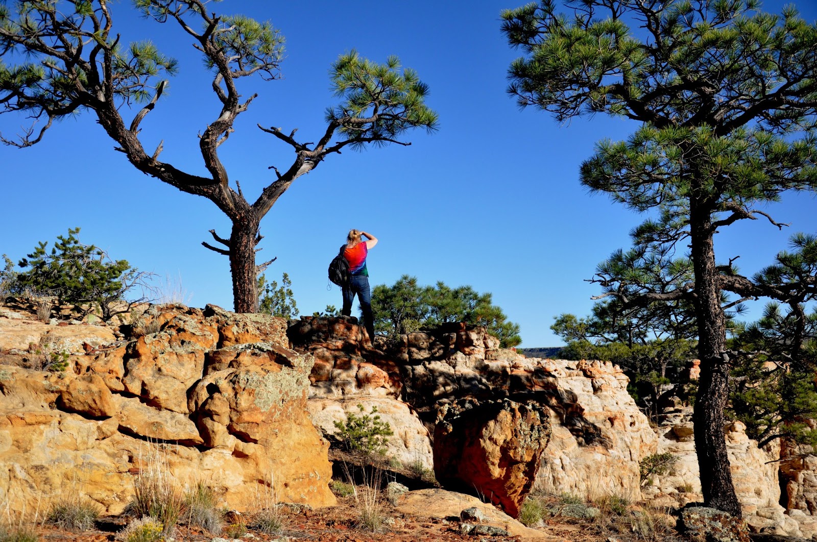
| My sister recording the beauty of the area |
It was so quiet the day were were there in October. It was the New Mexico of my youth when you could hear the ants crawl if you listened. And the sky was such a vivid clean blue. Mining roads up and down through here to the proposed biggest uranium mine in the world just across the valley would ruin that. And leave a patina of dust all over the beautiful rocks, choking the life out of vegetation that struggles with the arid environment.
Just because you have not been there do not let them destroy it. Or contaminate the aquifer for all the residents in the area and anywhere on the aquifer. The closed uranium mine near Milan just a few miles south is already doing that. And the uranium is not even for us.